|
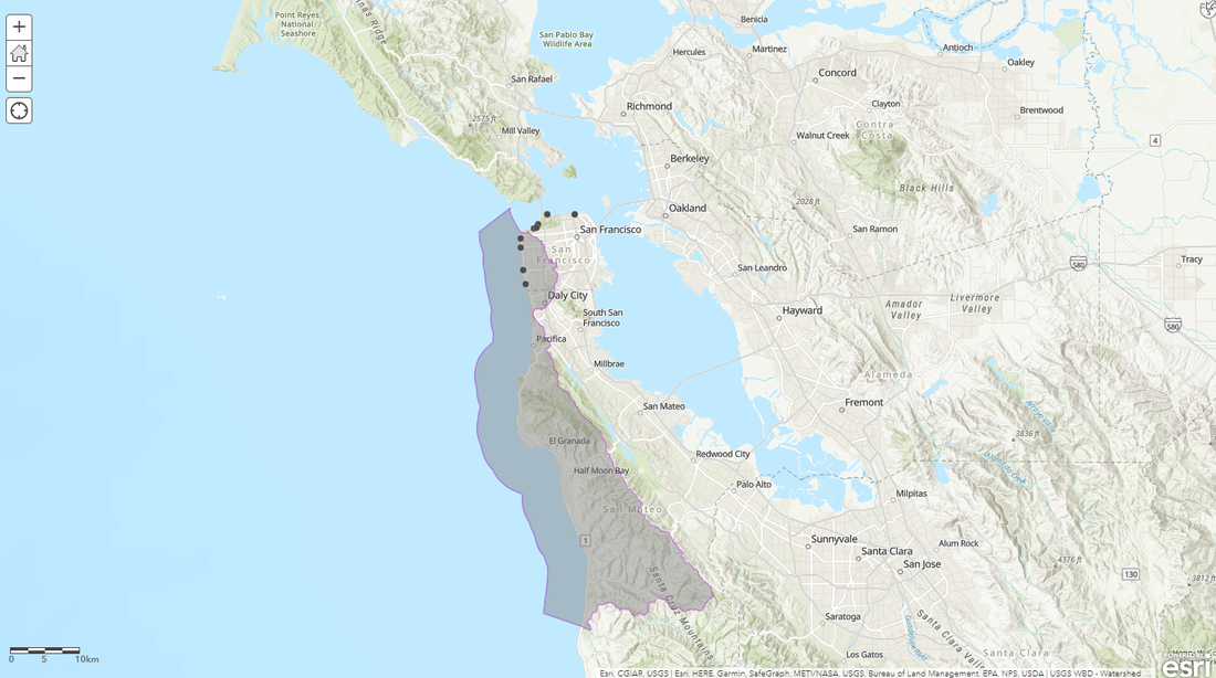
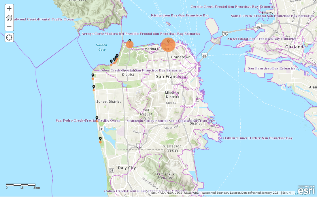
By Yesenia Perez A geographic information based system, ArcGIS collects, analyzes and interprets data to create a map that can explore real world environmental problems. It is a powerful and engaging tool that is used in a variety of career fields, but usually not taught to students until environmentally focused college courses. ArcGIS is a tool that can prompt exploration of the Earth’s geography and natural systems and fosters critical thinking. Bringing ArcGIS into high school classrooms revitalizes traditional environmental science lessons. Furthermore, it is a way to introduce a technical tool that is a highly advantageous skill set and important exposure for high school students preparing themselves for future career pathways. Last fall, the Energize School’s team reimagined the Watersheds and Public Water Systems curriculum to work for virtual learning with support from NOAA's Bay Watershed and Training program. This curriculum incorporates ArcGIS as a tool for students to map their local watershed. With each step of the mapping process students explore their watershed more deeply and create a visual representation of their understanding layer by layer, data piece by data piece. In this application, ArcGIS can be used to identify, analyze and mitigate human impacts on watersheds. In early March, SEI staff joined a virtual classroom of students at Abraham Lincoln High School in San Francisco and led two lessons, taking students through the process of mapping their watershed in ArcGIS. Students uploaded watershed boundaries onto their maps, and highlighted the boundary of their watershed. They also uploaded recent water quality data from sites along the coast of San Francisco, and explored how to highlight the meaning of those water quality measures on their map. Student ArcGIS maps of their watershed and water quality data Beyond its roles in the creation of students' local watershed maps, analyzing water quality data is a way to prompt larger conversations in the classrooms about the intersection of geography, climate change systems and environmental justice issues. Students came away from these two classes with foundational ArcGIS skills, and with a new understanding of their watershed, and some of the threats it faces.
For teachers, this distance learning adapted curriculum can be requested at any time and a recorded teacher training that introduces this ArcGIS project in a comprehensive and clear way is also available. Learn more about SEI’s sustainability curriculum and opportunities for schools here.
2 Comments
Leave a Reply. |
Get In TouchDo you know an environmental leader who should be featured in a story? Reach out to [email protected]. Categories
All
Archives
April 2024
|
 RSS Feed
Get Involved
|
Contact Us
|
SEI Headquarters
100 Smith Ranch Road, Suite 124 San Rafael, CA 94903 Phone: (415) 507 - 2181 Email: [email protected] States where we work:
Arizona California Colorado Indiana Maryland New Mexico New York New Jersey North Carolina Oregon Washington Virginia |
ConnectSubscribe to the SEI quarterly newsletter to get involved and receive updates
|
SEI is a 501(c)3 nonprofit organization.